Site Owners
Pilots
Download our app below to start discovering new landing sites


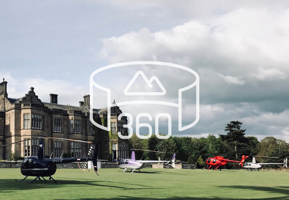
Helicopter landings are very exciting, for site owners as well as their guests. We constantly strive to make landings as safe and convenient as possible, for pilots as well as those on the ground.
If you’ve already registered a helicopter landing site within Helipaddy, the chances are you’ve already given pilots a breakdown of the information you deem to be important, in the form of Landing Instructions and Warnings. The feedback we’ve had from Pilots, time and time again, is that this information can be missing critical points that a non-person-of-the-sky might not understand the pertinence of. The most popular of these are high telephone cables blocking the approach or livestock present at the landing zone.
Similarly, although once a great step towards increased safety, using only Google satellite imaging to review a landing site is no longer sufficient.
“With Helipaddy’s 360 Survey, we’ve ensured safety and reduced noise, all while boosting our property’s appeal to pilots.” Dave Page, Heliport Base Manager, Penzance Helicopters
Of course, we use it to show pilots where to land, but it won’t suffice for reviewing all the dangers in close proximity. This is why, through our 360 Survey, we introduced features such as the 360 Pad View for all cardinal directions. Through the process, site owners become the pilots’ eyes.
Our goal has always been to facilitate the exchange of relevant information between owner and pilot, so from November 2022, we’ve rolled out the Helipaddy 360 Site Survey feature. We help you to gather all of the key information for pilots using natural language, meaning that anybody can fill this out for pilots. We have avoided jargon as much as possible bearing in mind the subject matter.
To do the survey you will need:
Log in to the Helipaddy Owners page at https://app.helipaddy.com/survey-360 or click the button above. Click on the Survey button to start. You don’t need to complete it in one go and you come back to it at any time.
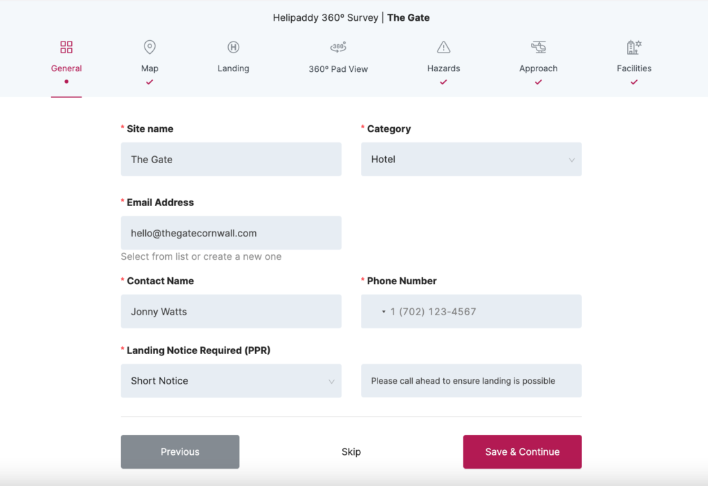
Here you will fill out the general information for your site, including contact information. Most of this information will be automatically filled in from the information you provided previously, but it’s a great opportunity for a quick review.
Pay extra attention to the Prior Permission Required (“PPR”) Notice period at the bottom – this tells a pilot how much notice you need before they can come and land at your site. If you have any animals, for example, it may be worth taking some extra time to ensure the animals are away from the landing location.
(Note: Press Save & Continue at the end of each page, to ensure all of your information has been saved)
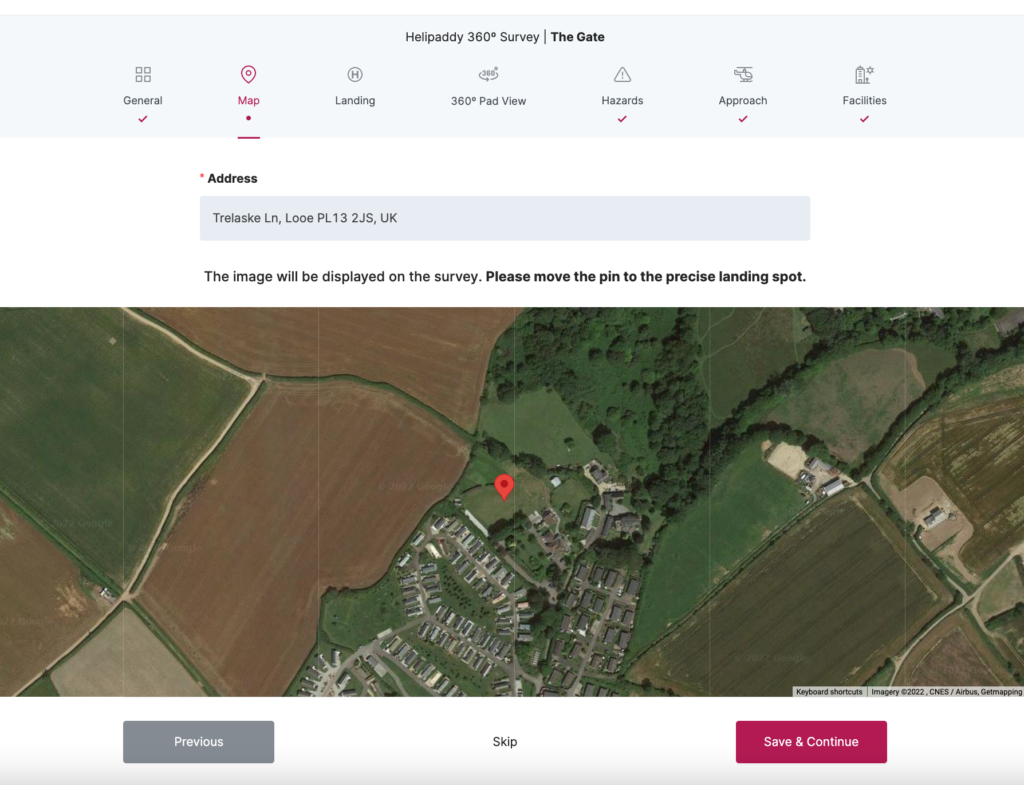
It’s important to show the pilot exactly where you’d like them to position their machine once landed. Fill in your address and simply drag & drop the red pin to the exact landing location. If you have two locations on your property, you should add the second one separately.
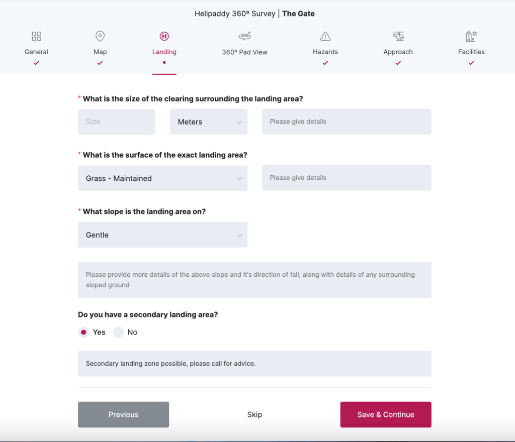
In this section, you will be asked to provide information on the designated landing space: the size, the surface type, and the slope.
While we ask you to try and make the information as precise as possible, it doesn’t need to be spot on. If your landing zone is a bit constrained, you can make estimates, but please err on the side of caution. The Pilot will use satellite imaging to check out the area before landing, but any extra information supplied will help them immensely.
At the end of the section, you will have the opportunity to add a secondary landing area, if you have one. Otherwise, save and move on to the next section!
Step away from the computer screen and go fetch your wellies!
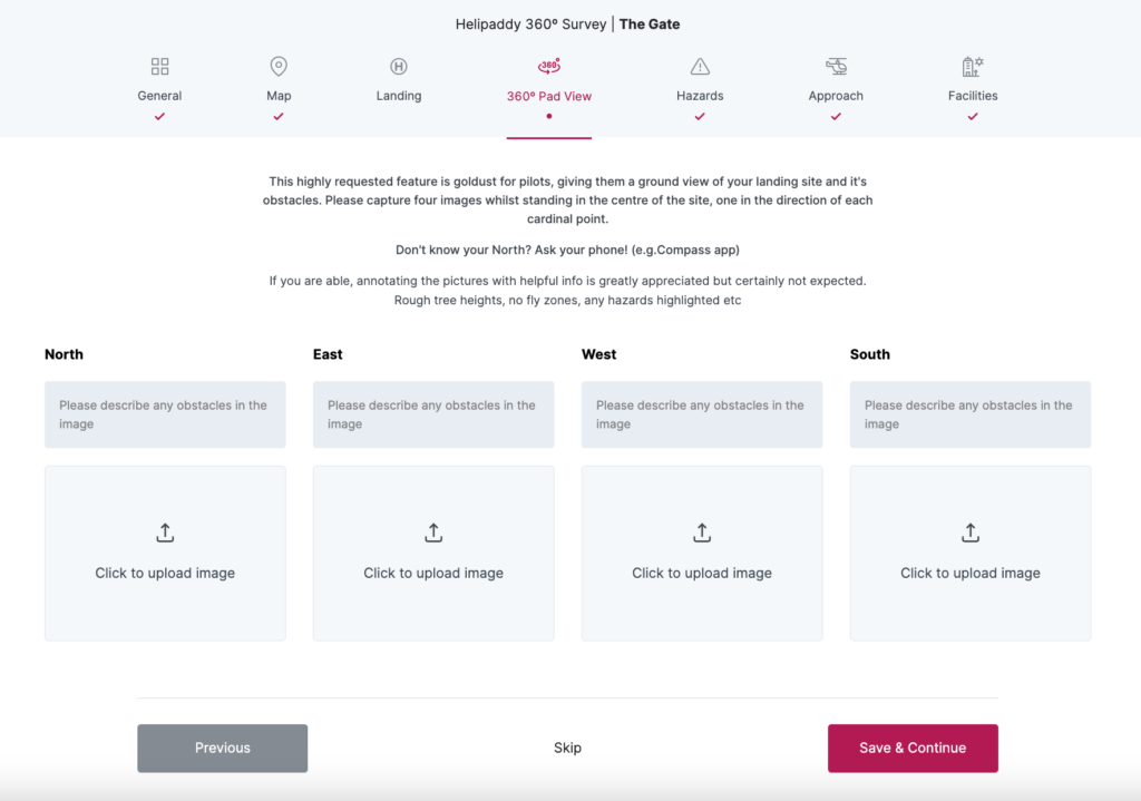
This is possibly the most impactful section for our Pilots – whilst they can see the landing site from above via satellite, they cannot have a look around from the ground. You will be their eyes and ears.
Stand directly in the centre of the designated landing spot, and pull up the compass app on your smartphone. Find the North, East, South, and West and capture a photo facing all four directions. Are there any objects in the way? What height roughly are the trees? Are there any hazards, such as power lines in the way?
Upload your pictures to the section and note your findings. Any extra information is greatly appreciated but absolutely not expected.
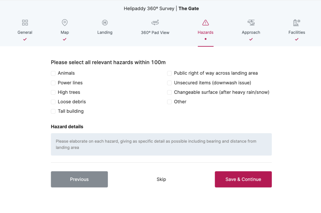
This is your opportunity to really hone in on your findings from the outdoor adventure above.
It’s as simple as ticking the appropriate options, of any relevant hazards you noticed within 100m. Want to go into more depth? Did you see something which we haven’t listed? Go to the textbox below and unleash your inner surveyor!
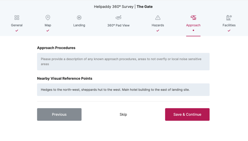
What should the pilot pay attention to on the way in and out
Approach Procedures
Are there any areas that the pilot should avoid? For example, do you have some livestock that may get startled by a helicopter? Do you have neighbours who may not appreciate the noise of a helicopter passing directly above their home? Let us know!
Please make sure that you are aware of the prevailing wind direction. In the U.K., this is from the South West. This means that around 75% of the time, pilots will start their approach from the North East.
Departure Procedures
Similarly, please be clear about whether you have a preferred departure direction. As with arrivals, all pilots will want to start their departure into the wind and will usually choose to avoid trees if possible. So if you need to specify a particular preference (normally due to animals or neighbouring properties), please provide this.
Nearby Visual Reference Points
Approaching a location from the sky can be a tricky task, especially in more crowded areas. There are no road signs in the sky, so Pilots have to use other points of reference to find the landing site. What should they look out for? Is there a shepherd’s hut somewhere? An area of water?
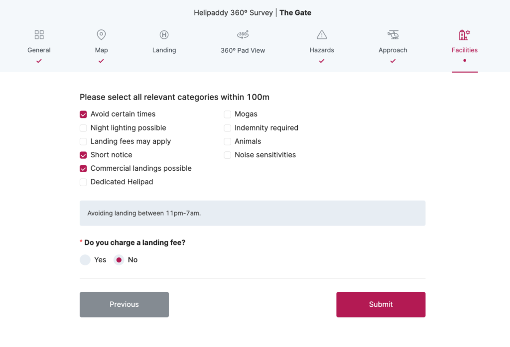
Let Pilots know what else you offer (i.e. fuel) and how much you charge for accommodating a landing.
The word in the Helipaddy community is that if pilots are already paying you for food/accommodation/services, they may be hesitant to pay extra for parking space, so bear this in mind. Please be aware that if you charge a landing fee, you may be unintentionally entering into a contract to provide a service under the law. Providing pilots with a survey is a great start.


4 thoughts on “Helipaddy 360 Survey”
Comments are closed.