Site Owners
Pilots
Download our app below to start discovering new landing sites


Flying a helicopter in mountainous terrain requires specialist skills, proper training and pre flight preparation to ensure safe operations, whilst maintaining situation awareness and adjusting your flying techniques to account for changing conditions, whilst being prepared for potential emergencies. This article covers some recommendations and considerations flight operation techniques for safely flying helicopters in the mountains including:
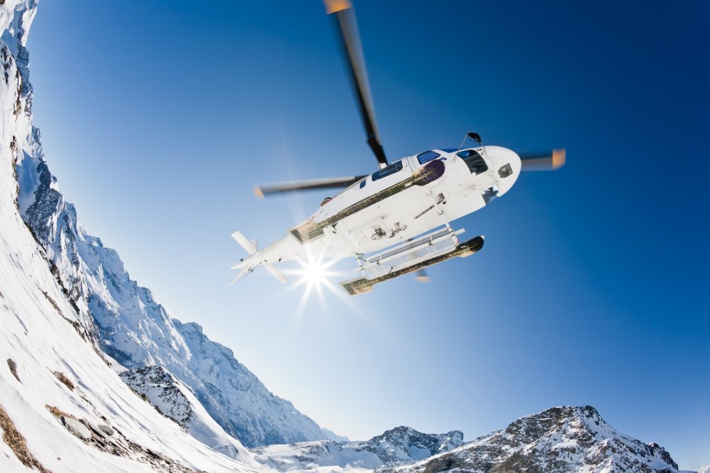
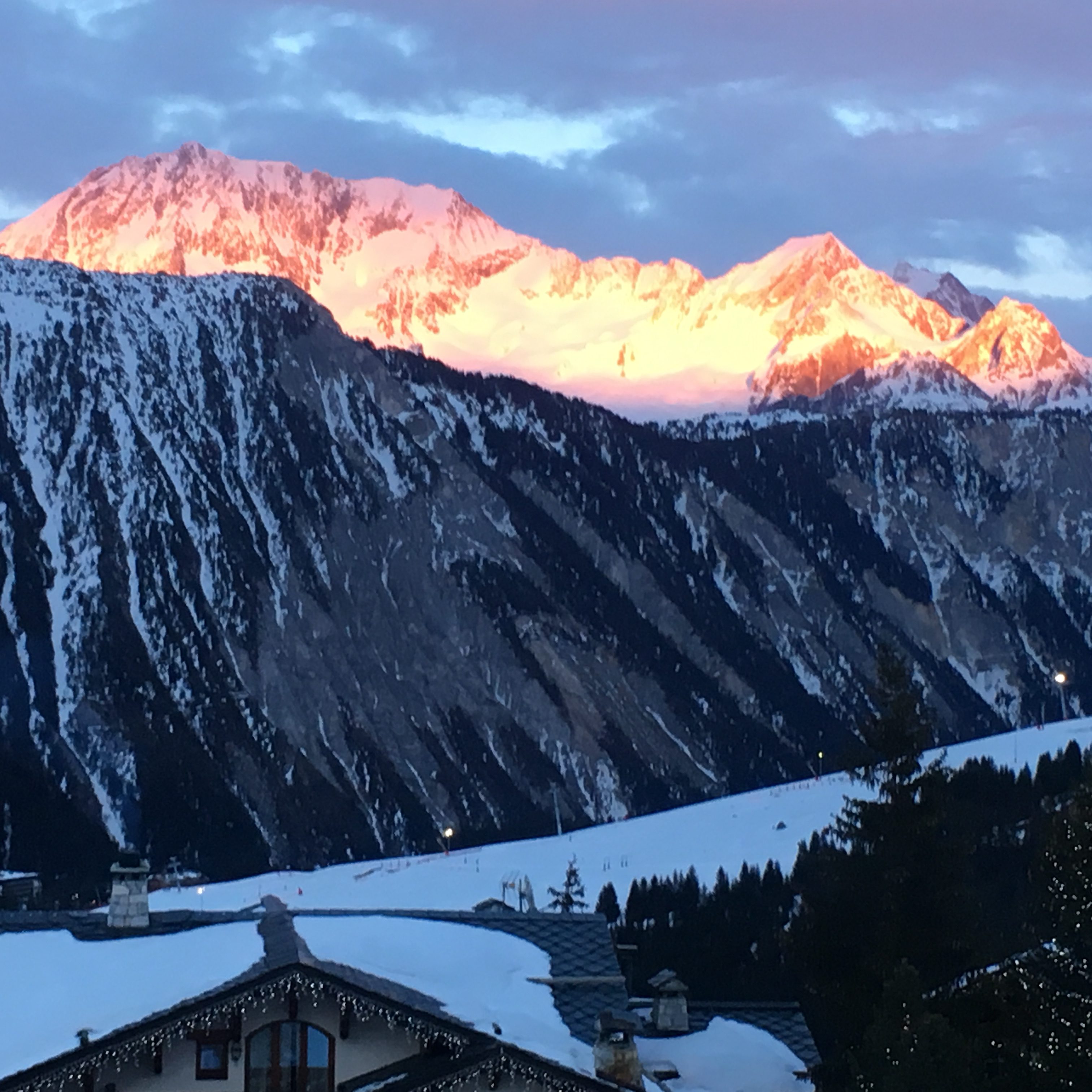
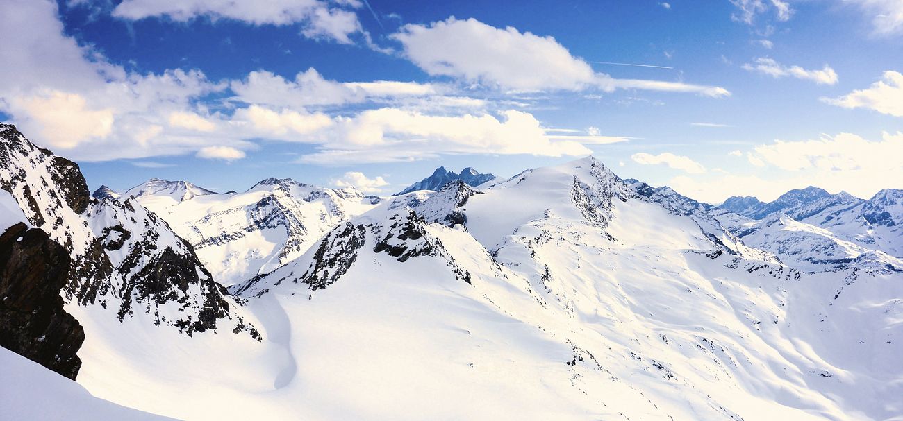
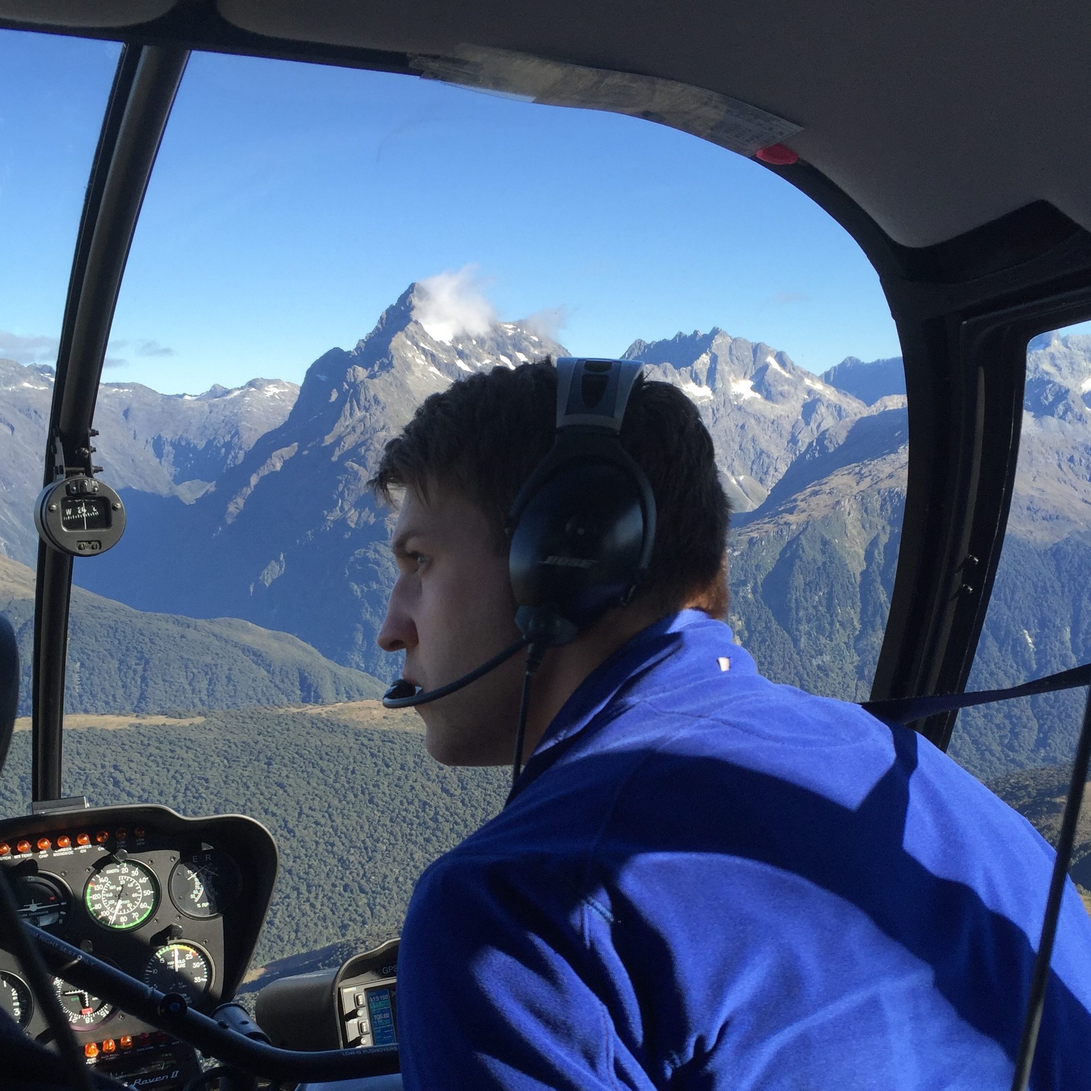
Flying in the mountains can lead to some of the most spectacular sights, and the unique abilities of the helicopter come into their own, allowing you to land in places that are inaccessible or incredibly difficult to reach by land transport alone.
Unfortunately history is littered with instances of aviation incidents occurring in mountainous areas, and the purpose of this article is to shed an insight into some inherent challenges of flying in mountainous terrain.
The article is by no means a comprehensive instructional guide to flying in the mountains- like many flying skills, reading alone doesn’t provide sufficient training, so seek formal instruction, and obtaining some ‘local knowledge’ of the area can be invaluable when trying to predict the localised weather patterns that mountainous areas can generate. Don’t forget to you check the rules and regulations of the country you are flying in if you intend to land- in Europe for example, some countries have restrictions on where you can land ‘off airfield’ or above a certain altitude (have a look at the country guides on the HeliPaddy blog to find out more).
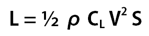
First off – let’s dive into aircraft performance – a major factor in many cases. Back to basics first though – the lift formula :
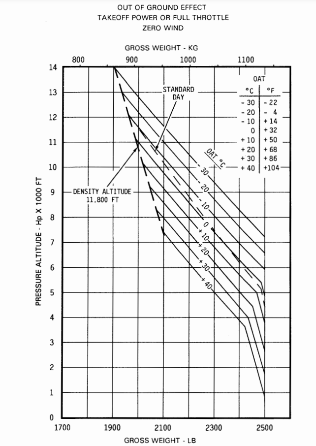
This shows that as the air density decreases, the lift produced by an aerofoil decreases- (with all other conditions the same). Therefore, as we go higher, in a helicopter aerofoil (rotor blades) have to work at a higher pitch angle, leading to a higher angle of attack to produce the same lift. This means that it may be operating closer to the stalling angle, and secondly, may be operating at a suboptimal lift to drag ratio – with higher drag on the blade. This leads to the second side of the density impact- engine power – and thus aircraft performance is will commonly decrease with altitude (unless the engine is ‘flat- rated’ or super/ turbo charged-) – so not only do you need more power to fly due to the increase in drag, but the power that you actually have available may be less. Irrespective of the actual height of the mountain, it is the density altitude that impacts the performance of the helicopter.
This can be seen on performance charts included in the flight manual- so – for example- look at an R44 Raven 2 helicopter – which can happily hover out of ground effect at sea level when fully laden (2500lbs), but at 8000 ft in standard ISA conditions- with the outside air temperature just around freezing, that drops to around 2250lbs (potentially two passengers worth of load!). The power margin has decreased.
An example of this occurred in 2008, where a R44 raven 1 helicopter was taking off from Courchevel altiport, at the end of a mountain training course.
Due to the location of the airfield in the French Alps- there is only one runway direction for take-off and landing – this meant the helicopter was taking off ‘downwind’ on this occasion. Despite the aircraft having 3 persons onboard, and thus within the max take-off weight- and having performance for a hover in ground effect, it didn’t have the performance for an out of ground effect hover. It failed to transition to forward flight and ended up on its side. Fortunately, in this instance – all 3 occupants escaped relatively unharmed.
A video from inside the cockpit of an R-66 that provides a graphic description when an aircraft is flown to the edge of its performance ceiling. Engine power is reduced and unable to match the demands of the pilot- as the pilot raises the collective further, the rotor rpm drops, (as evident by the LOW RPM horn). Going back to our formula before, as the blade velocity decreases, so does the lift (which is related to the square of the blade velocity), so even thought the pitch angle, angle of attack and lift coefficient increase; there is a greater decrease in lift from the velocity reduction- as the blades spin slower.
Fortunately in this instance, the occupants escape the mishap, but the helicopter shortly catches fire after the landing. This highlights another important factor covered later, survival gear, and appropriate clothing! You may have to spend the night on a mountain side- make sure you have some provisions – water, food – warm clothing to hand!
As the density altitude increases, there is also a reduction in the maximum speed of the helicopter, caused by retreating blade stall. As more power is required, the blade pitch angle increases, therefore the retreating blade runs closer to the stalling angle of attack. This can be felt with an increase in abnormal vibration from the main rotor, and if continued, a rapid pitch up of the nose and a roll in the direction of the stalled rotor (i.e. to the left in a Robinson). The tail rotor will also be working at a higher blade angle at higher density altitudes, and whilst the Robinson series of helicopters has a good range of tail rotor authority, some helicopter types are more susceptible to ‘loss of tail rotor authority’

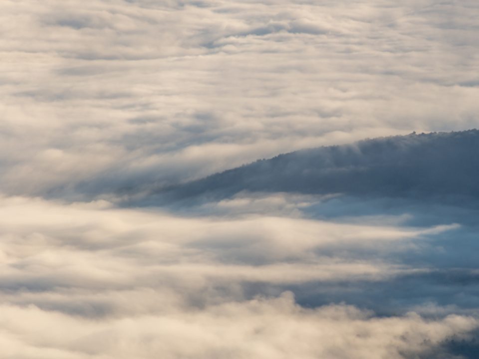
Weather in mountains can be severe, rapidly change and have large, local variations in both cloud precipitation, and wind, which can change significantly from one side of a mountain range to the other.
Unfortunately, often there are limited sources of weather reporting stations in mountainous areas, and those that do exist are usually situated in the valleys, where conditions may be very different. This prevents you from being able to build a comprehensive situational awareness, which can increase the risk of inadvertent flight into cloud or poor visibility due to limited weather forecasting and reporting.
Even a mountain pass that appears clear when you are about to take off from a valley can change rapidly to become blocked by the time you arrive there, especially if the region is influenced by moist, coastal air.
VFR flying in poor visibility in the mountains is especially risky due to potential to obscure rising terrain, obstacles of the poor visual contrast between the sky, clouds and snow covered ground.
Even in the U.K., where the highest peaks are mere hills compared to the alpine regions in Europe, there are unfortunately numerous accident reports when a serviceable helicopter has been flown into the rising terrain due to loss of visual references. Flying in the mountains after dark is strongly discouraged without the aid of specialist equipment and training, such as night vision imagery (goggles), thermal / infra red cameras and pilot controlled high intensity search lights.
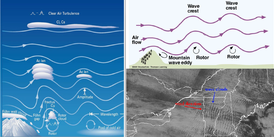
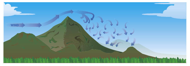
Wind is usually present in the mountains, it can accelerate through passes and have areas of turbulent flow at the top of peaks and ridges- causing ‘mountain waves’ , which can be incredibly violent, dangerous and unpleasant to be in, with severe down drafts usually found on the lee side (downwind side) of the hill or past sharp mountain edges- these can be in excess of 3000ft / minute, which could be in excess of you maximum rate of climb available.
To help visualise the wind in the mountains, imagine the flow of water in a river around a large rock, and relate the rapid turbulent water movement behind and passing immediately over the rock as the airflow conditions to expect around a mountain peak. When the wind is funned between two mountains then the wind speed increases (think Bernoulli principle!).
The best advice if you find yourself caught in an unpleasant up/down draft or turbulence is to turn out of the airflow as quickly as possible –to try and get out of the flowing air. If stuck in a downdraft, apply maximum power and set the maximum rate of climb speed of the helicopter to minimise the rate of descent.
Trying to climb above the level of turbulent air can lead to the helicopter flying into icing conditions, which the helicopter is not able to cope with. Safe conditions may only exist in the early morning and late afternoon when the air is stable.
Some helicopters are inherently more at risk of damage when flying in turbulent air, due to the risk of ‘low g’ mast bumping, such as the Robinson series with the teetering rotor head.
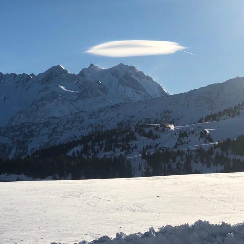
Look for the distinctive lenticular ‘cap’ clouds on top of a mountain that can indicate the presence of strong ‘rotor clouds’ below and behind a mountain. Rotors can sometimes be recognised by small ragged, wispy bits of cloud beneath a mountain wave cloud – however, be aware if there is insufficient moisture for cloud formation, these rotors may be invisible. In the Swiss Alps, if there is a 5-8 mb difference between two stations at similar altitude (such as Zurich and Milan), north and south of the range, mountain waves can be expected for example.
To find out more about mountain waves, click on the link below to watch a short video (Skybrary)
Surfaces that are exposed to the sun, or local sea/lake breezes can create localised winds – anabatic (winds up the mountain) or katakabic winds (caused by the Föhn Effect) that blow down the lee side of a mountain, may not be experienced at a higher level, leading to a sense of false security when assessing a suitable landing site (see section on high and low reconnaissance) .
Mountain surfaces that are dry and clear of vegetation will warm (and cool) faster than an area covered in vegetation, leading to increased thermal updrafts on an exposed sunlit slope.
Even navigating can be more of a challenge in mountainous areas. You may only be able to see the valley in front of you- cloud may obscure the sides of the hills and prevent you from climbing to get a better perspective of upcoming features.
Orientation can be difficult with total snow cover, as there is less definition of the surface – ridges and passes are more uniform in appearance, the gradient of slopes are indistinguishable due to lack of depth perception, and on a cloudy day, the a snowy surface can be indistinguishable from the sky.
Even the most familiar terrain can become unfamiliar to the most experienced mountain flying pilots. Flying in the mountains often puts you below the level of the surrounding peaks, removing the natural horizon and denying you of visual references that are used to interpret terrain and slopes.
Other optical illusions include a lack of horizon, a false horizon caused by a gentle mountain slope blending into the background, or a lack of depth perception caused by uniform white surfaces
This visual illusion can lead to spatial disorientation, potentially resulting in loss of control or impact with the surface, so keep a regular cross check of the instruments in the cockpit to check the helicopter attitude, airspeed and altitude.
In the absence of an accurate horizon, there is a natural tenancy to accelerate when flying along descending terrain (potentially leading to exceed of VNE and retreating rotor stall) and to decelerate when approaching rising terrain due to the apparent position of the surface against the cockpit (with the danger of being on the ‘back side of the power curve’ requiring more power to fly, or falling into vortex ring state if the speed drops below approx 30kts as the helicopter starts to descend).
Even lighting can cause challenges, for example, the position of the sun can mean there are areas of deep shadow in the early morning or evening. Conversely, when the sunlight is subdued, there is a risk of ‘white-out’.
Note: This is not the white-out caused by loose snow when coming into land – we will cover that later, but when a large unbroken expanse of snow has no defining surface texture, disguising any gradient or surface feature, and can lead to the land and the sky margining to one- preventing you from judging height and distance.
“In conditions where the light is reduced by an overcast sky, the result may be that everything turns into a flattened white surface. You can easily lose your horizon under such conditions and the ability to judge height and distance become impossible. Patches of clouds beneath the overcast sky may also blend in with the background and become invisible. This may result inadvertently entering IMC conditions and maybe a very dangerous situation during low-level flying”
Tips for safe operation- General Aviation guide to flying in Norway –
Brightout is another optical challenge relating to lighting conditions, and occurs when you are flying with clear sky, and bright sunlight from overhead, in snow covered areas. The NZ CAA highlights the issues from this : “no shadows are cast because of the bright reflection from the snow. This can give a false representation of what you are flying over and cause partial disorientation. There is virtually no visible definition, and as a result hummocks and ridges will appear flat on unmarked snow. This can be a problem for helicopter pilots operating close to the surface”.
It is also worth noting that through the natural obstacles of the mountains, other aircraft traffic are concentrated into the same airspace- especially if the area is used for scenic tours or heli skiing.
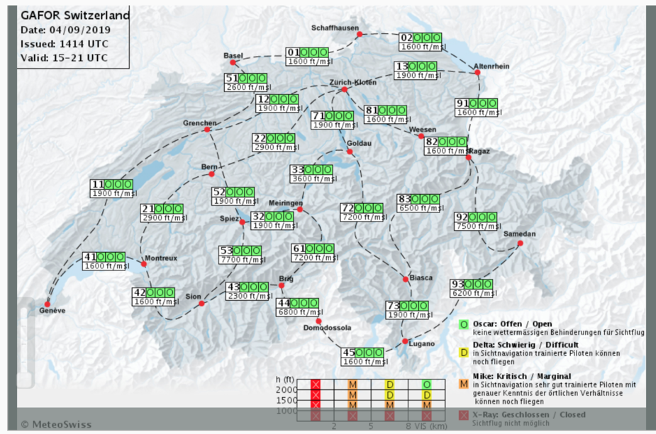
Some countries have preset routes through the alps that are marked on the appropriate chart, for example, the GAFOR (General aviation forecast) routes in Switzerland, which are marked with a simple corresponding code to indicate the weather conditions along each segment of the route. Updates on the conditions of these routes can be obtained from the Swiss Meteo website, and some flight planning software (such as Sky Demon) automatically imports the data to graphically display it on the moving map.
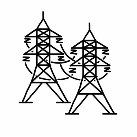
Unfortunately – flying into wires and cables remain the number one cause of fatal accidents in helicopters, when flying in mountainous terrain, especially when tracking along a valley, be aware of cables that may span across a valley- scan the terrain either side of the flight path for any towers- you will not see the actual wires in time.
If possible – try and fly directly over the towers when crossing any wires- and be aware that there may be guide wires that run above the more visible wires, or low strung, extremely thin cables (such as the tragic case of a HEMS AW139 crash in Ras al-Khaimah, Dubai, in December 2018, which struck a ‘zip wire’ tourist attraction that ran across the valley. )
When landing, be aware that the surface may not be level or constitute a smooth and firm surface. Often on mountain side landing sites, there will be large rocks that can possibly increase the risk of dynamic rollover, or can cause a hazard to the tail rotor during landing.
Before planning for a landing in a mountainous area, remember that the conditions on the valley floor will not be replicated on the mountain side. Consider preparations in the event of an unscheduled landing.
From a personal level, make sure you dress/ pack appropriately, to account for cooler conditions and any inclement weather. This includes bottled water, a fully charged phone, a fire lighting device and a means of attracting attention to a passing search aircraft, such as a mirror, high visibility reflective device or flare. Check that the helicopter first aid kit is up to date and has suitable provisions.

Also be aware of the impact of hypoxia above 10,000ft, which can impede your cognitive functions. The onset of hypoxia is difficult to identify by oneself and can lead to overconfidence and lack of judgement. Aim to limit your exposure above 10,000ft (assuming you do not have oxygen onboard) to a maximum of 30 minutes, but be aware that the effect of altitude impacts each person differently, depending on fitness, age and lung capacity- for example , heavy smokers may be susceptible to the effects at lower altitudes.
Before embarking in a trip to the mountains, it is worth reviewing the emergency procedure section of the flight manual (section 3).
The terrain and surface means the safe force landing areas are few and far between, so revise what the minimum rate of descent and max range autorotation profiles are for your helicopter (e.g. max range 90kts, 90% RPM, or min rate of descent profile at 60kts, 100% for the R44), so you can best position the helicopter if you need to land and consider practicing various emergencies with an instructor prior to setting off, so you are well prepared.

If you are planning to operate in the mountains for an extended period, ensure that the aircraft maintenance is up to date, (e.g. any existing deferred defects that could impact operation has been rectified) with plenty of time before any next periodic check items. As you may be operating in a remote area, it is recommended to stock up on consumable fluids , such as engine oil, and brining it in the helicopter.

It is also good practice to ensure that the aircraft wind shield is cleaned of any bugs or dirt prior to flight – don’t assume you will be the only one operating in the area- and hiding behind every bug spatter could be another aircraft, wire , or object!
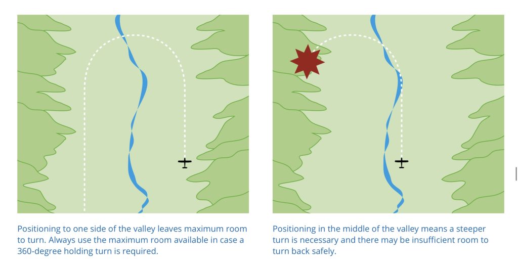
When flying in mountains- it is always important to plan an ‘escape route’- you may not have the performance to climb out of a valley and over ridge line, so you need to ensure the width of the valley is wide enough to match the turn radius of a 180° turn to escape out of a valley, if visual references or turbulence makes further progress unsafe. Beware of flying up ‘dead end valleys’, know what occurs at the end of the valley, does it open up to flat terrain or what elevation does it climb up too. There is an old adage from mountain flying, “never fly up a valley you haven’t previously flown down”.
If transiting across a ridgeline, ideally, this means approaching any rising ground at a 45° angle from at least half a mile away, so if you don’t have the performance to climb over the ridge or (safely land), you can turn into the descending ground (preferably into wind), thereby increasing the vertical clearance with the terrain.
If you are using a 180° turn as the escape route, remember that slowing down will tighten the turn, but requires more power, and the radius will increase as you get to higher density altitudes.
One of the key differences between landing in mountains and that of flatter terrain is the height above the ground that the high and low reconnaissance is performed at, and that most approaches will not be carried out directly into wind.
Approaches are usually carried out from the windward side, to avoid turbulence, downdrafts and rotor clouds caused on the lee side of any ridge cross wind.
Instead of approaching the landing site into wind, flying in a straight line as you might at lower, flatter terrain, in the mountains you typically start your approach with the wind blowing laterally or even from behind, and turn into the wind at the final stage. Selecting the appropriate approach path is the most important decision that is made during your reconnaissance procedures.
When assessing a landing site, when the wind speed increases, prepare to increase the gradient of your approach to make it steeper. Similarly, if the landing site is bounded by a steep ridge line, increase the approach gradient to avoid the area of turbulent air and downdrafts behind the ridge.
Straight in Approaches, carried out from the lee side of a mountain, – directly into wind- , whilst uncommon, can be carried out safely in the following conditions
The Swiss training website, Glacier Landings, splits the objectives of the high and low reconnaissance into the following:
When performing the reconnaissance of the landing site- look out for the items covered in the 5 ‘S checklist with specific attention to any obstacles on the landing site, such as wires and supporting structures and poles- bearing in mind that a low hover might be necessary prior to setting down to ensure that is nothing that might be hidden in tall grass (such as uneven, rocky terrain) that could impact the helicopter structure or imbalance the helicopter on landing .
Landings in snow also have the additional challenge of potential white out (from loose blown snow), and uncertainly on the surface of the landing site. Hazards include ice which may cause the helicopter to slide or spin on the slope – especially if the helicopter is shut down, when the engine torque overcomes the ground friction, causing the helicopter to spin, before the tail rotor is at sufficient RPM to generate sufficient anti torque force. Soft powered snow may not support the weight of the helicopter- if it sinks in, there is a potential for the tail rotor to hit the snow causing damage to the blades and drive shaft, or the risk of dynamic roll over as one skid gets stuck in the snow on take-off.
It may not be possible to judge the slope of the surface due to the uniform surface conditions – meaning a landing may be attempted out of maximum permitted slope limits.
Note on judging elevation and height above the ground : If you have a radar altimeter (which is a fantastic piece of kit) – it will only give you an indication of the terrain clearance directly below you – not what is in front. It is very difficult to judge distance and scale in the mountains – especially when confronted with a uniform, featureless terrain. – Try and determine height and distance by using an object of known size (such as a person) as a reference point.
Correctly assessing the wind direction is critical to making a safe approach- the wind strength will be higher over mountain passes than at the base of the valley, and expect up draughts on the mountain side exposed to the sun – with down drafts on the cooler, shaded side. If possible, operate on the windward side of any hill to avoid down drafts and rotor clouds.
Assessing the wind direction in the mountains can be difficult, look for visual clues if there is any smoke, waves and smooth sections on surface water (lakes), movement of vegetation, or the shadows of clouds moving across the surface.
If none of the above is available, perform a constant airspeed/ height/ angle of bank 360 degree turn and note the movement of the helicopter against a fixed point on the ground or by GPS to determine overall drift of the helicopter, and therefore the prevailing local wind direction.
Often a quick chat with a ‘local pilot’ can help you understand how the conditions vary between time of day – the patterns can be relatively predicable below 15 kt, but less so in stronger winds or if the air has been influenced by a preceding ridge line. In general, the atmosphere will be more stable, early in the morning.
When assessing a landing site, when the wind speed increases, prepare to increase the gradient of your approach to make it steeper. Similarly, if the landing site is bounded by a steep ridge line, increase the approach gradient to avoid the area of turbulent air and downdrafts behind the ridge.
Always ensure you are making an approach with the best possible escape route available, that doesn’t take you into rising terrain, and ensure you have sufficient space to turn away (e.g. when flying in a narrow valley).
The decision point as the last position during the approach that allows you to turn away and go around without increasing power, whilst and the escape path is the route you will follow from the decision point onward, should you need to escape from an approach. Once the escape window is closed, you must land in any case. It is much safer to land hard with no forward speed than to hit the ground while you are accelerating in a go-around.
Before committing to a landing site, make sure you carry out a power check, so you know the power margin you have – even if ‘on paper’ you should have the required performance. If you are in doubt of the performance, abort the approach, and either find a landing site at a lower altitude, or reduce the load onboard the aircraft- e.g. disembark passengers, cargo or equipment back at base, or burn off additional fuel to lighten the helicopter.
If you reach the maximum power available, any subsequent increase in collective will cause a droop in the Rotor RPM, reducing the lift and making the situation very dangerous. If you are operating with a low power margin, avoid sudden deccelerative attitude changes and ‘lead’ any power changes with plenty of time.
The specific approach technique that you select for each landing varies according to the conditions and the site- even a site you have been too the previous day may require a different profile if the wind speeds or direction has changed.
‘Glacier landings’ website has a number of highly detailed ‘worked examples’ that you can follow through of mountain landing sites across the Swiss Alps as good preparation .
Due to the natural obstacles of the mountains, other aircraft traffic that cannot fly over the mountain tops are funnelled into an concentrated area of airspace- especially if the area is used for scenic tours or heli skiing.
As such, you should always be keeping a good look out for traffic and monitoring any local area radio frequency that often exists in the mountains (such as 130.000mhz in the French Alps), but bear in mind that ground based ‘traffic services’ for other aircraft separation may not provide reliable cover due to the mountains blocking the line of sight.
Additionally the bright sun reflecting off the white snow may make objects hard to distinguish- there was a tragic accident in the Aosta valley near Turin in the Italian Alps in January 2019, when a helicopter and light aircraft collided shortly after take-off, but never appeared to see each other until the impact occurred.
Consider investing in a personal locator beacon (PBL) or a satellite flight following device, such as ‘Spider tracks‘ which monitors your aircraft’s flight route and records specific flight information such as location, speed, altitude, and precise GPS position in real time, so that someone knows where you are. If you have to make a precautionary landing or the helicopter becomes disabled, the mountains can be an incredibly difficult area to successfully conduct a search for you! At the least, filling a flight plan will point the authorities in the right direction!
Here are some good references to find out more about mountain flying :
Flying in the mountains and hills can be spectacular, but due to the challenging and dynamic conditions, you should do so with the right skills and knowledge to appreciate the additional factors and risks, and seek instruction from an experienced mountain pilot to learn the correct techniques to fly safely.
In summary, the International Helicopter Safety Team outlined 12 concerns for pilots to be aware of in the mountains, which are worth repeating :


One thought on “Mountain Flying”