Site Owners
Pilots
Download our app below to start discovering new landing sites


A fun day awaits at the Tour de France Stage 2, easily accessible and comfortably achievable by helicopter with ample daylight for your return (for example, if coming from France, Belgium or south UK).
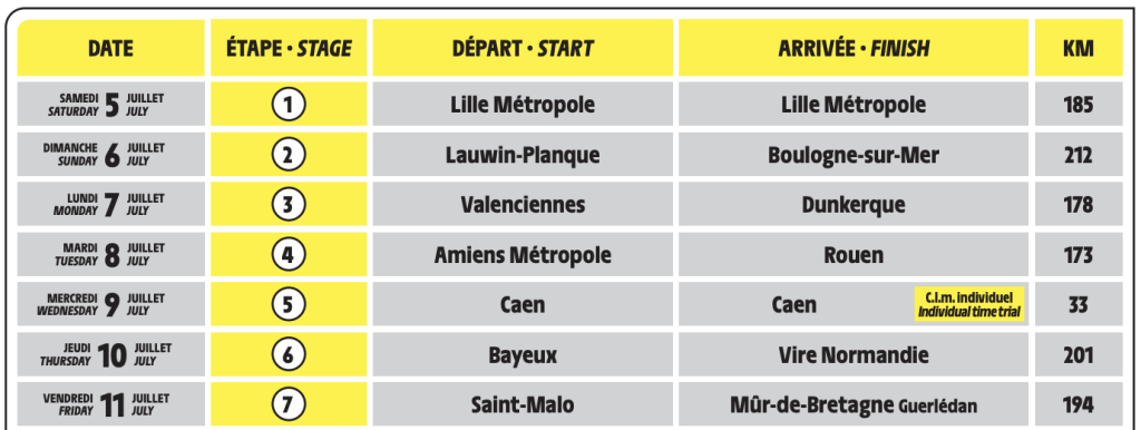
There’s good reason to think that the Yellow Jersey could find a new owner in Boulogne-sur-Mer, where this stage the 2025 Tour’s punchy finishes will take place. Stage 2 of the Tour de France 2025 is a 212km hilly stage from Lauwin-Planque to Boulogne-sur-Mer. Early on, the peloton rides through Douai and Arras. Four climbs feature in the second half of the race, and the finish is uphill too. This suggests that Stage 2 will favour the puncheurs.
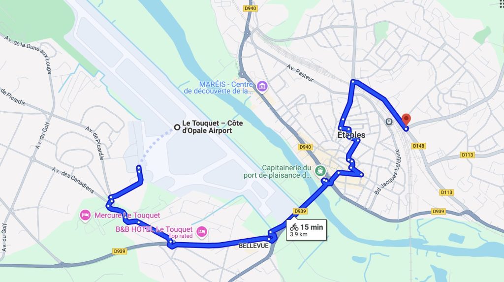
Upon landing at Le Touquet–Elizabeth II Airport, you’ll find excellent facilities designed specifically with helicopter pilots in mind. The airfield boasts dedicated helicopter parking right on the main apron. With customs conveniently located on-site from 07:00 to 20:00 local time (2-hour prior notice is required outside these hours), entry formalities are a breeze.
Fuelling needs are well catered for, with AVGAS 100LL and JET A-1 available throughout the published operating hours, and even after-hours fuelling via bowser on call-out.
To fully experience the excitement of the Tour, a convenient bike rental service is available inside the terminal, costing only about €2 per hour, helmets included. Transition from helicopter to bicycle in a swift two minutes—no bus transfers needed!
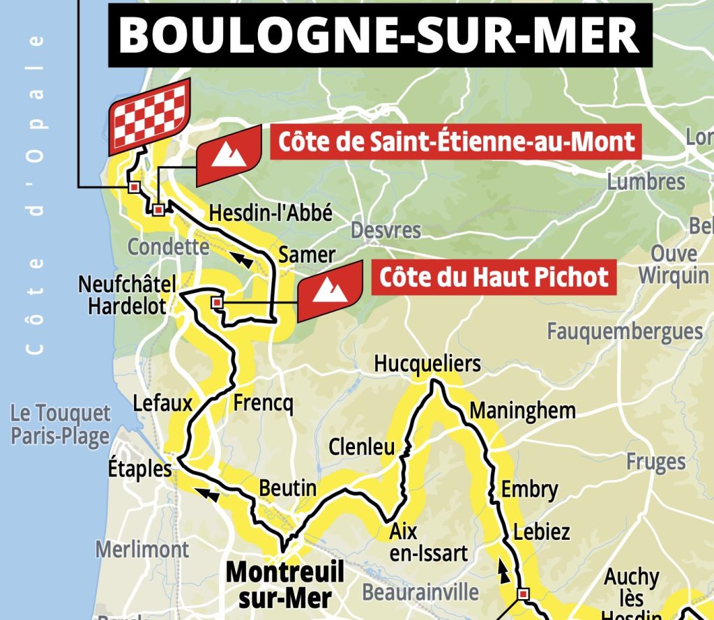
From the LFAT apron, take an easy, flat 5 km ride to the Avenue de Verdun feed zone, perfectly positioned to witness the riders at km 155 of their 209 km journey.
Expect the peloton to pass between 15:35 and 15:56 CEST. Park your bike securely opposite the Carrefour car park and enjoy fantastic views by positioning yourself just two metres behind the crowd barrier.
For those preferring a dramatic climb experience, book a quick taxi ride to Hardelot (Carrefour D940 / Chemin des Pins), around 20 km away (approximately 25 minutes, ~€35).
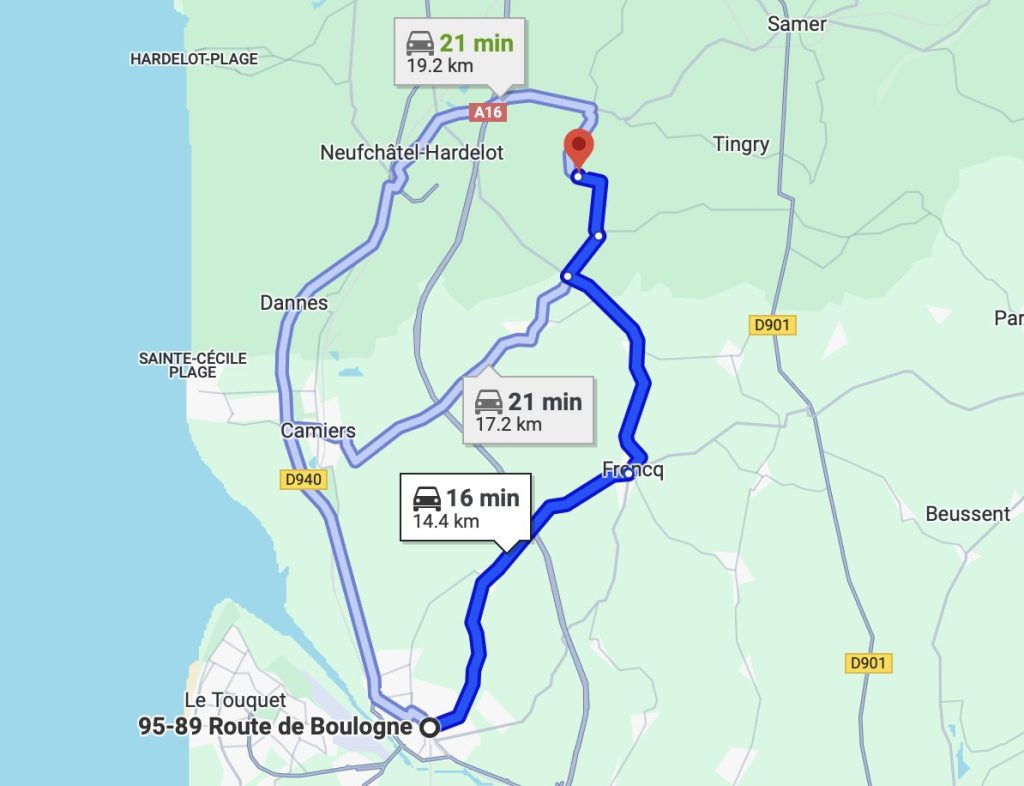
The Côte du Haut Pichot climb provides an unforgettable spectacle, featuring a challenging 1 km ascent at a 10.3% gradient, cresting at km 179.5. Anticipate the riders between 15:57 and 16:22 CEST. To ensure a prime viewing spot among dense crowds, arrive before 15:30 and keep your taxi driver close by, ready for your prompt return.
Preparation is straightforward: file your outbound flight plan and GAR from the UK to LFAT. En route, remain below the Paris TMA at 3,000 ft until you reach the French coast. Monitor London Information 124.6 initially, then Lille FIS 120.27 MHz closer to France. Also see Helipaddy France and Helisurface.
If you want to fly lower, coast out at Beachy Head and skirt round the infuriating DA across the channel.
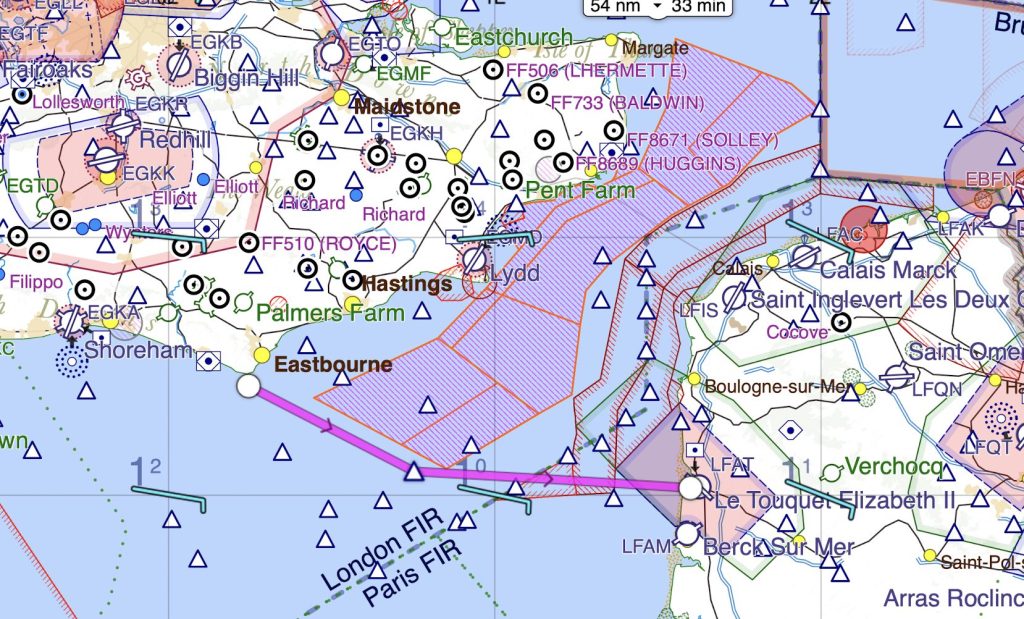
On arrival at LFAT, cancel your flight plan with the tower on 118.45 MHz, park conveniently, and walk straight to customs.
When you’re ready to head home, uplift fuel, file your return flight plan, get your passports stamped at customs, and lift directly across the Channel, arriving back in the UK well before dusk (9.15pm local time).


Thanks for this post.
Dear Helipaddy, thanks for heads up. Your members might want to avoid “Canceling” their flight plans when arriving at LFAT but closing them in the absence of ATC!
Furthermore your link re Helisurface shows a permit if granted to land outside airfields if criteria are met-which is not necessary to have if landing at LFAT or any other licenced airfield.
Best Wishes Richard Hubbard